

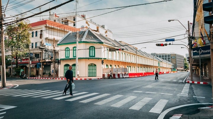
A few historic streets in Bangkok
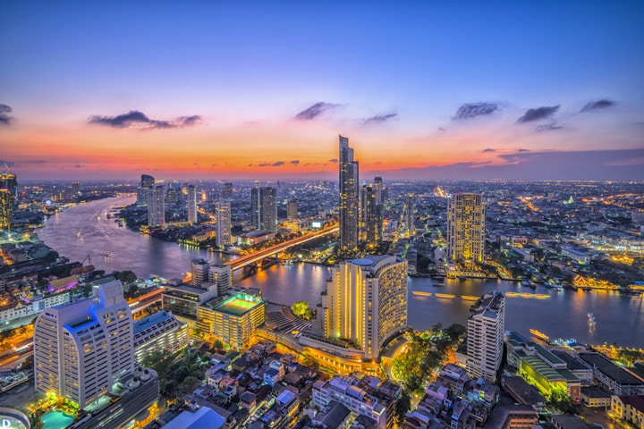
The Chao Phraya in Bangkok
You wouldn't say it at first sight, but the streets of Bangkok have not only played a crucial role in the opening up of the city, but also in the actual urban development.
Originally, most traffic in the Thai capital - just as it had been in predecessor Ayutthaya - took place by boat. The Chao Phraya was the highway, while the many klongs or canals acted as local roads. Water transport had the great advantage that it was significantly faster than land transport. Boats were faster than heavily loaded bullock carts and, moreover, traffic took place on unpaved roads or paths, which was no fun, especially in the rainy season.
The reason for the construction of the first 'modern' road in Bangkok was a petition that was delivered to King Mongkut on August 19, 1861 by several Western consuls. In it they complained about their health problems due to a… lack of roads where they could travel by horse and buggy. They requested the king to build a new, wide road on the eastern side of Chao Phraya behind the district where most of the Western consulates and businesses were located. The king agreed to the request and ordered the construction of this parallel to the river, in two stages.
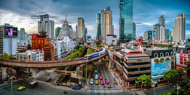
The route ran from the old city moat, crossed the Phadung Krumg Kasem Canal and continued through the European Quarter to end in Bang Kho Laem, where the river made a sharp turn to the east. The second phase, within the ancient city walls, ran from Wat Pho to the earlier section at Saphan Lek. The construction, which was the first to work with a paved foundation layer, started in 1862. The work apparently progressed well, because on March 16, 1864, the road was solemnly opened to traffic. It was not customary at that time to officially name streets and the road became known as Thanon Mai or the New Road. It was only later that Mongkut gave it the name Charoen Krung, which means "prosperous city" or "prosperity of the city". In 1922, the entire route was renovated and asphalted. Today, the official length of Charoen Krung is 8,6 km. The road starts at Sanam Chai Road at the Grand Palace and ends at Charoenkrung Pracharak Hospital.
Charoen Krung Road (Sunat Praphanwong / Shutterstock.com)
Almost immediately after Charoen Krung Road was completed, the king had a canal dug from the French Consulate to the Thanon Trong Canal, connecting the latter to the Chao Phraya River via the existing Bang Rak Canal. The dredged soil was used to build a new road that ran alongside the canal on the south bank, connecting the Charoen Krung and Trong roads. The construction cost a lot of money and so Mongkut with some insistence asked for financial contributions from wealthy property owners, who helped build bridges over canals crossed by the road. The new canal and road were initially known as Khlong Khwang and Thanon Khwang but later got the name Si Lom, which literally translates as windmill. It was most likely a reference to a windmill erected in the area near the rice mill of German businessman Pickenpack, who was also a Dutch consul in Bangkok for a while. The mill sculpture erected a few years ago at the crossroads of Silom with Naradhiwas is a reminder of this.
Silom in Bangkok (Craig S. Schuler / Shutterstock.com)
Agricultural activities first developed along Silom Road, but this soon changed when, between 1890 and 1900, some far-sighted developers built Si Lom roads and dug canals (Sathon Road in the south, and Surawong and Si Phraya in the north) through which the area which is now Bang Rak District was opened up which in turn attracted businesses and wealthy residents. The district quickly grew in importance and in 1925 there was even a tram line. In the XNUMXs, this area received a major boost when the first real high-rise buildings appeared along Silom Road. The large concentration of banks and other financial institutions has earned this street the nickname of 'Wall Street of Thailand' and land prices are among the highest in the country.
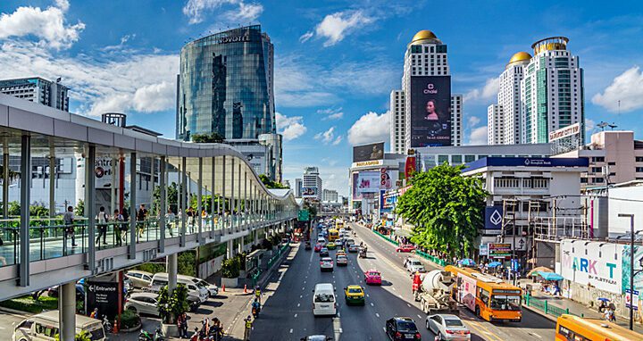
Sukhumvit Road (Adumm76 / Shutterstock.com)
Equally renowned as a concentration area for businessmen is Sukhumvit Road. It is one of the busiest arteries in the Thai capital and is in fact the starting point of Thailand Route 3, a real highway that - largely parallel to the coast - via Samut Prakan, Chonburi, Rayong, Chantaburi and Trat to the border crossing with Cambodia in Amphoe Klong Yai. What few people still know is that this extremely busy and wide road was built around 1890 on the orders of King Chulalongkorn to speed up the advance of troops from the garrison of Bangkok to the eastern border, which was threatened at the time by, among other things, the French colonial troops. So originally Sukhumvit Road had a military function. But now, together with the many soi's or side streets, it forms the beating heart of the business district. Incidentally, I'm bold enough to think that some of our readers are more familiar with some of these side streets, notably Nanaplaza and Soi Cowboy, which can be considered fun spots or hellholes according to personal preference...
Ratchadamnoen Avenue (somkanae sawatdinak / Shutterstock.com)
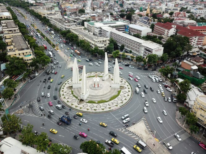
The most politically charged thoroughfare in the capital is undoubtedly Thanon Ratchadamnoen or Ratchadamnoen Avenue. No street reflects the ebb and flow of the turbulent Thai politics of the last hundred years or so more than this wide and stately avenue that connects the Grand Palace and Ananta Samakhom Throne Hall in Dusit. The name of the street, which literally means 'royal processional road', well reflects what it was built between 1899 and 1903 by order of King Chulalongkorn. During his visit to Europe in 1897, he was deeply impressed by avenues such as the Champs Elysée in Paris and Unter den Linden in Berlin. He therefore wanted a wide avenue, with countless shady trees, for the royal parades as a model and showcase for the modern monarchy that he aspired to.
The avenue has been the site of many key moments in recent Thai history, beginning with the non-violent and successful 1932 coup that ended absolute monarchy, to the October 1973 student uprising that culminated in a series of mass demonstrations in which more than half a million demonstrators filled the avenue until on October 14, security forces with the support of tanks and helicopters ended the protest, leaving 77 dead and 857 injured. This carnage brought about the fall of the highly unpopular military-led cabinet of Field Marshal Thanom Kittikachorn, who saved his ass by fleeing abroad…
Not to mention the implications of the more recent political protests and subsequent military repression in 2009 and 2010 – the latter of which resulted in more than 20 deaths along Ratchadamnoen Klang – to the mass demonstrations of the pro-democracy movements of the last two years. One of the reasons why this avenue is so often the subject of politically colored actions and demonstrations lies in the strong, historically charged symbolism that the street exudes. In the last part, near and in Dusit, there are numerous government buildings, including the Government House, which is the official residence of the Prime Minister and the cabinet. In addition, there are also a number of monuments that have a direct link with the recent turbulent history. There is the monument that commemorates the events and victims of October 1973, but especially the imposing Anusawari Prachathipathai or Democracy Monument that was built in 1939 on a roundabout in the middle of the avenue and is not only an iconic element of Thanon Ratchadamnoen but has also become a gathering point for countless demonstrations.
Khao San Road (NP27 / Shutterstock.com)
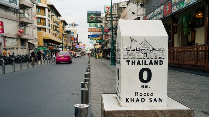
I like to end with the street that has become the most famous in the city for most tourists: Thanon Khao San or the Khao San Road, which is extremely popular with backpackers. It actually originated as a street connecting Chakrabongse Road and Ratchadamnoen Klang Road, cutting across one of the main 19e century rice markets in the city. You can hardly imagine it today but well into the 19e century, this district was hardly built on and you could mainly find rice fields here. Proof of this lies in the nearby Wat Chana Songkhram Ratchaworamahawihan which was widely known as 'the Temple in the Rice Fields'… The street is mostly famous/notorious for the motley collection of loud street vendors, smoky food stalls, tattoo parlors, edible insects, cheap hotels and countless restaurants and bars that were frequented daily by thousands of tourists in pre-corona times…
Not exactly my thing, but to each his own, isn't it?
“Not to mention the implications of the more recent political protests and subsequent military repression in 2009 and 2010 – the latter of which resulted in more than 20 deaths along Ratchadamnoen Klang –”
Black May 1992 is also worth mentioning given the many deaths and buildings that went up in flames. At the time, there were rumors that the missing had been dumped into jungles by planes. Fake news back then because remnants were never found, I thought?
https://en.m.wikipedia.org/wiki/Black_May_(1992)
Rama 4 is also such an old waterway where a lot happened after it became a road and then I think of 2013-2014 where history was also written.
You can't deny that people are watching humbly!
New rd/Charoen Krung was also exactly the route of the very first city tram line (around 1900, I believe), so line 1. City bus 1 still runs that route.
As for the Rachadamnoen Avenue, the following. Many buildings there date from the period associated with the June 1932 revolution that converted the absolute monarchy into a constitutional monarchy. That memory must be erased. Wikipedia says:
In January 2020, it was announced that ten buildings flanking a 1.2 kilometer stretch of the avenue, owned by the Crown Property Bureau, would be renovated or demolished. The bureau proposes rebuilding the structures in “neoclassical-style”, obliterating the Art Deco theme originally inspired by the spirit of the 1932 revolution that overthrew absolute monarchy.[
Thanks, Lung Jan for this interesting article.
I have always understood that Rama 4 is just a bit older than Charoen Krung, and would therefore be the first road in Bangkok (also commissioned by Rama 4).
See https://en.wikipedia.org/wiki/Rama_IV_Road
When I think of historic roads in BKK (according to the cabinet, we should call this Krung Thep Maha Nakhon in a proposal adopted on Tuesday), I do indeed think of these roads. But also Thanon Yaowarat (ถนนเยาวราช, royal son street) in Chinatown and Witthayu Road (ถนนวิทยุ, radio street).
If I look a little further, I think of Thanon Farang Songklong
(ถนนฝรั่งส่องกล้อง, Farang with binoculars/binoculars street). That road in Ayutthaya was a straight road, and as the name indicates by a farang with a sighting instrument.